Begin with the Instagram feed of the Leventhal Map Center of the Boston Public Library; every day they post an interesting historical map.
Here are some case studies using maps that I’ve come across recently for us to start with and consider.
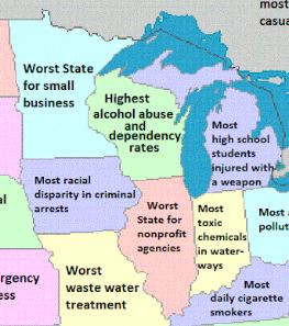
Map of US with states labeled by how they’re ranked “worst” (Maps on the Web Tumblr)
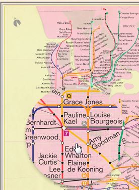
What if the NY Subway Map stops were all named for women?
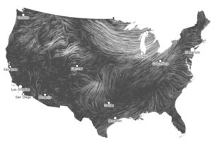
Current wind patterns, mapped onto the US
Could North America be re-mapped into 11 nations?

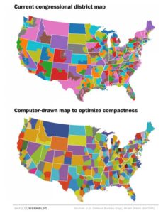
What if there were no gerrymandering?
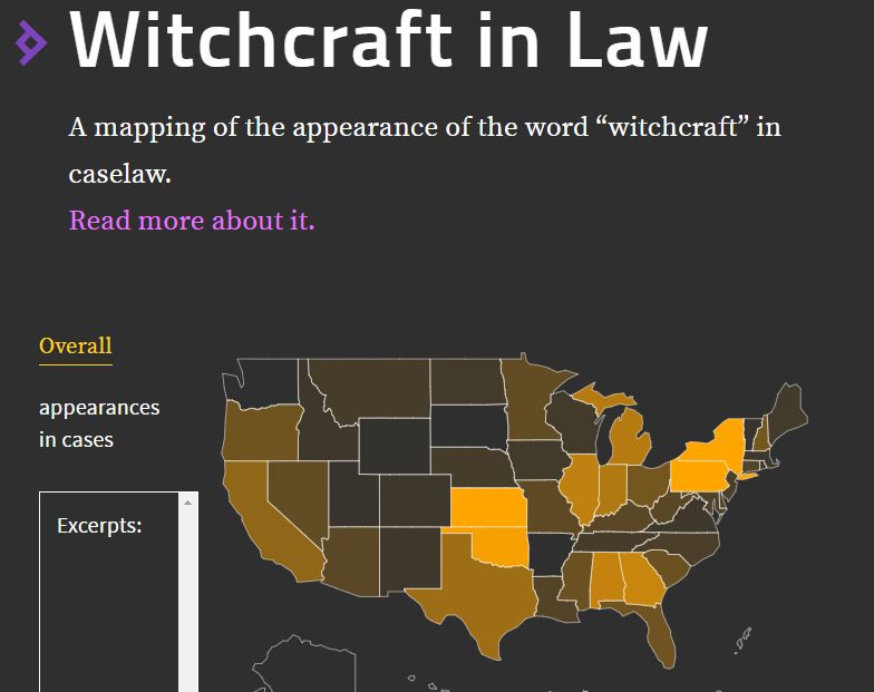
Mapping “witchcraft” in case law (appropos of Halloween)
After exploring those, spend some time exploring a few other links related to historical maps or mapping as a historical method. A recent article in Forbes magazine talks about how digital mapping helps us understand racism and the history of segregation, including:
- Placing Segregation (Univ of Iowa)
- Civil War Washington (NEH / Univ of Nebraska Lincoln)
- The Opportunity Atlas using Census data
An especially expansive and beautiful digital library of maps (at high resolution) is David Rumsey Map Collection (Stanford University)
Stanford hosts the Mapping the Republic of Letters project from Dan Edelstein and Paula Findlen, tracing (and mapping) the trajectory of thousands of letters from the pens of European Enlightenment writers. Here’s a brief video explaining the project:
Other innovative projects work with recreating or layering historical maps, and creating digital environments of the past (We will talk more about this on our Digital History day next month). Some examples include:
- Historical Locations on Google Earth
- HistoryPin
- The Clio App
- Rome Reborn
- Pleiades Ancient Gazeteer
- Roman World
- Urban Simulation Team (UCLA)
- Welikia Project (“New York City” in 1609)
- The work of ScholarsLab (UVA)
- The Work of NULab for Texts, Maps, and Networks (Northeastern)